 I have decided to do a pictorial history of our experiences at Woodpecker Hollow from the first time we ever laid eyes on it. I will try to post it so that it follows the proper dating of the posts, but failing that will at least create the diary and provide a link to it from here. Also, I am going to open up (as much as the host service will permit) the blog to others so that all who use our land may be able to share and express their experiences here.
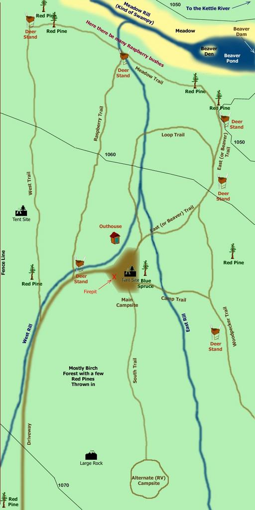
The picture inserted here (click on the image to see it full size) is a site map of the property showing the trails and creeks and other features. This map will be updated soon since over the past year and a half, many changes have already occured.